
Report: Simple, Inexpensive Experiment Proves Earth is Round!
Report: On the Flat Earth, How High is the Sun?
Bruce Lacey on “A Flat Earther’s Journey and Perspective.” (Dec. 12th)
PDF Discussion, Links to Videos of the Presentation
Web Article: On the Flat Earth, The Sun Never Sets!
Web Article: Flat Earth Claim that Sun Acts Like a “Spotlight” — DISPROVED!
by Dave Thomas
Flat Earthers like to say that the Sun casts like like a spotlight as it floats above the flat earth, which explains day and night. This page shows that this claim, pictured below, is FALSE.
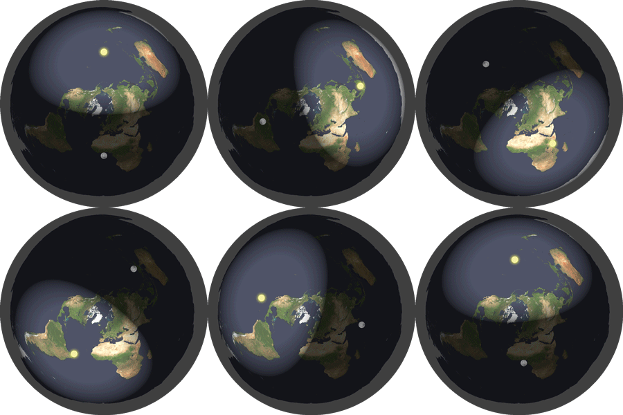
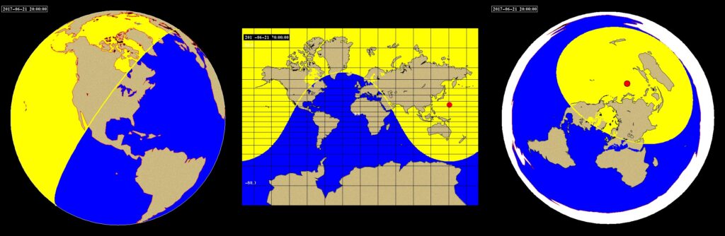
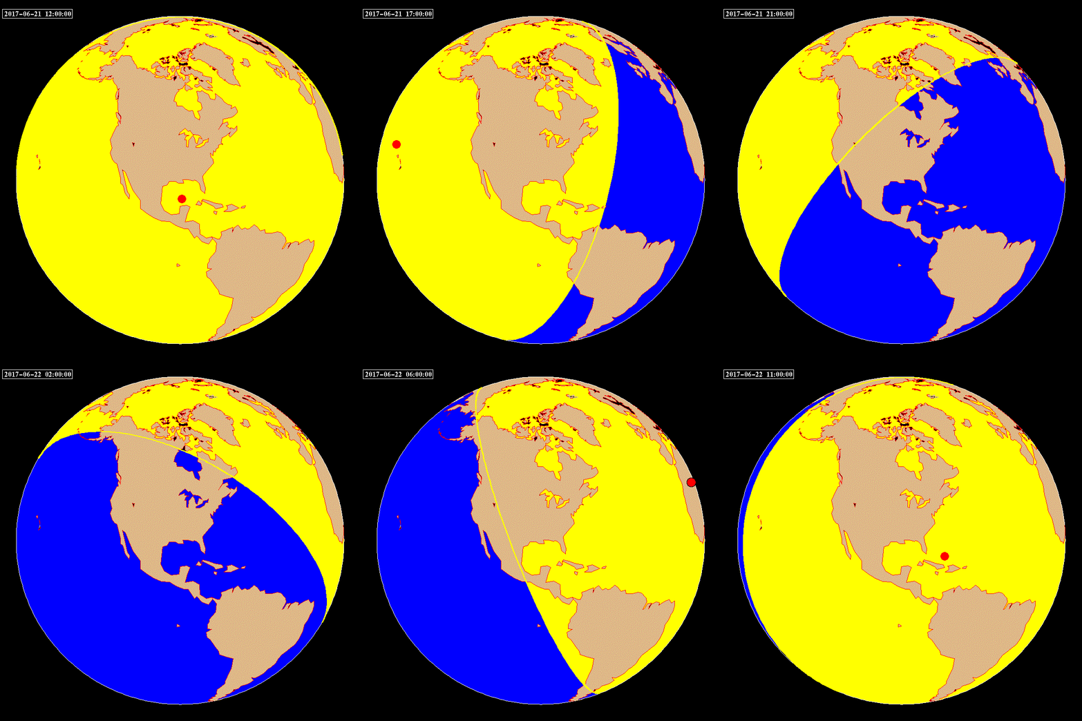
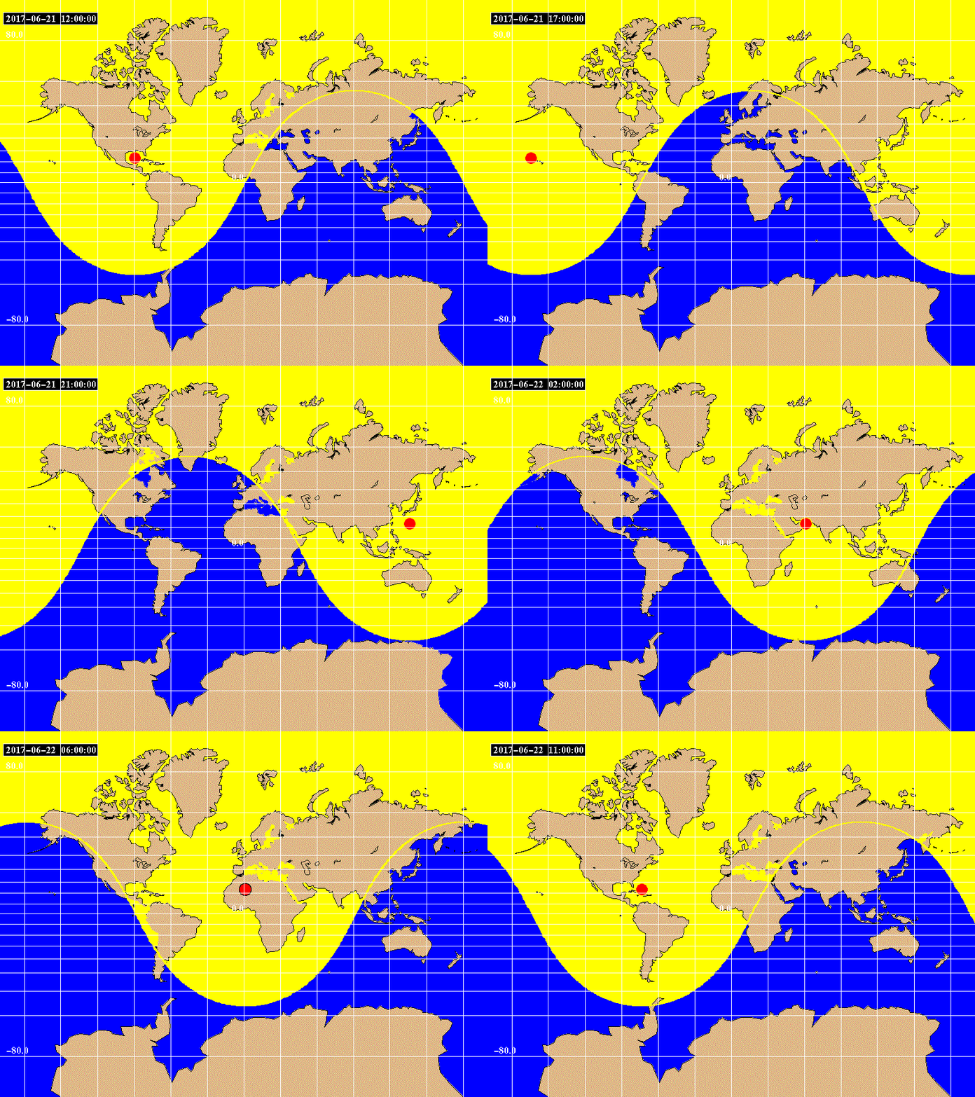
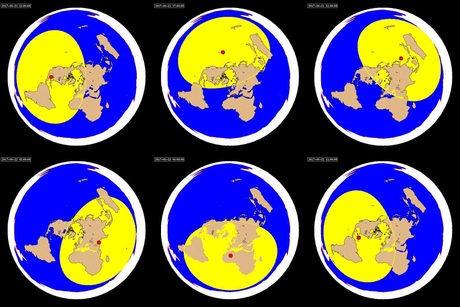
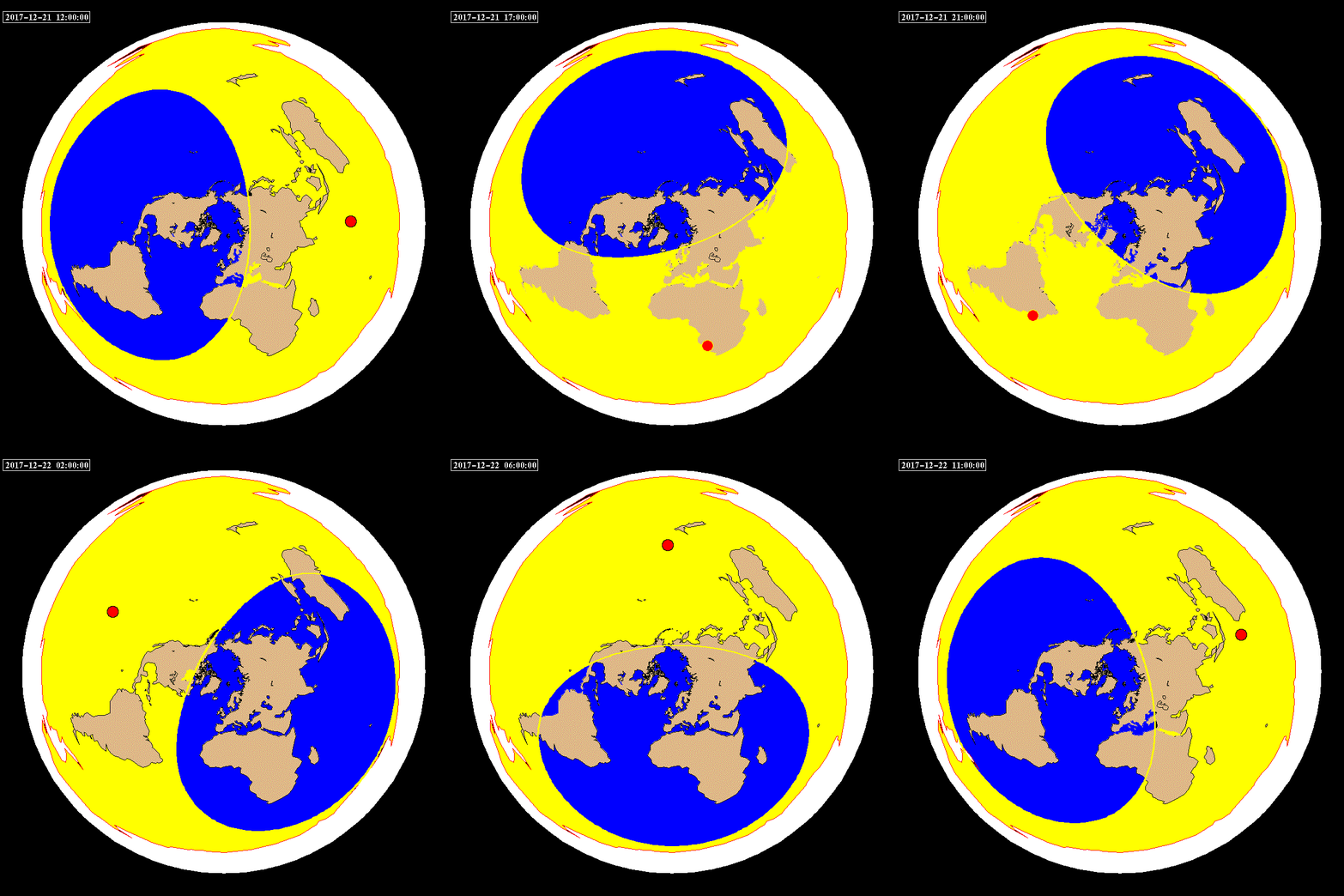
The following images and animations show three different types of Map Projections: The Orthographic Projection (which looks like a Globe, viewed from various directions), the Mercator Projection (commonly used, although it makes arctic regions like Greenland appear too large), and the Polar Azimuthal Equidistant Projection (which Flat Earthers claim is the only proper representation of the Flat Earth).
The maps and animations which follow show the progression of Day and Night in both summer and winter.
This map shows night and day for the Summer Solstice, for noon in Sydney, Australia. Note that the three map projections all indicate that Alaska, Russia and northern Greenland are in sunlight, while nighttime is happening in Florida, South America and Africa.
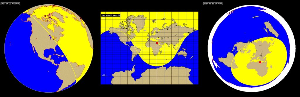
This next map shows night and day for the Summer Solstice, for eight hours later, which is noon in Cairo, Egypt. Note that the three map projections all indicate that Maine and Brazil are in sunlight, while nighttime is happening in Alaska, Florida and western South America.
Here are animations of each of the three projections, for a Summer Solstice day. Note that the northern Arctic is in sunlight all day, as this is the time for “Land of the Midnight Sun” in the north. Also note that the Sun (red circle) goes above China, Saudi Arabia, the Sahara Desert, and Mexico in each map projection.
The Polar Azimuthal map shows that daylight changes as indicated in the Flat Earth animation above. Also note, however, that all three animations show the same countries and cities experiencing Night and Day.
These next maps show night and day for the peak of Winter. This is when it gets rather thorny for the Flat Earth Movement.
This map shows night and day for the Winter Solstice, for noon in Greenland. Note that the three map projections all indicate that South America, Africa and southern Greenland are in sunlight, while nighttime is happening in Alaska, northern Greenland, and Norway.
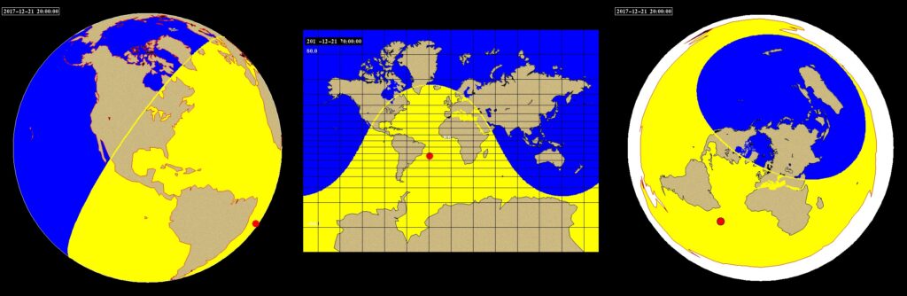
This next map shows night and day for the Winter Solstice, for eight hours later, noon in Anchorage, Alaska. Note that the three map projections all indicate that Alaska, Florida and western South America are in sunlight, while nighttime is happening in Maine and Brazil.
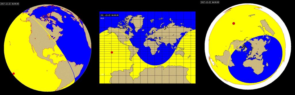
Here are animations of each of the three projections, for a Winter Solstice day. Note that Antarctica is in sunlight all day, as this is the time for “Land of the Midnight Sun” in the south. Note carefully that the northern part of Greenland is in night the whole time, and that only the southern tip of Greenland gets any sunlight at all, in all three map projections. Also note that the Sun (red circle) goes above Australia, Madagascar, southern Africa, and South America in each map projection.
This time, however, daylight does NOT change as indicated in the Flat Earth animation above.
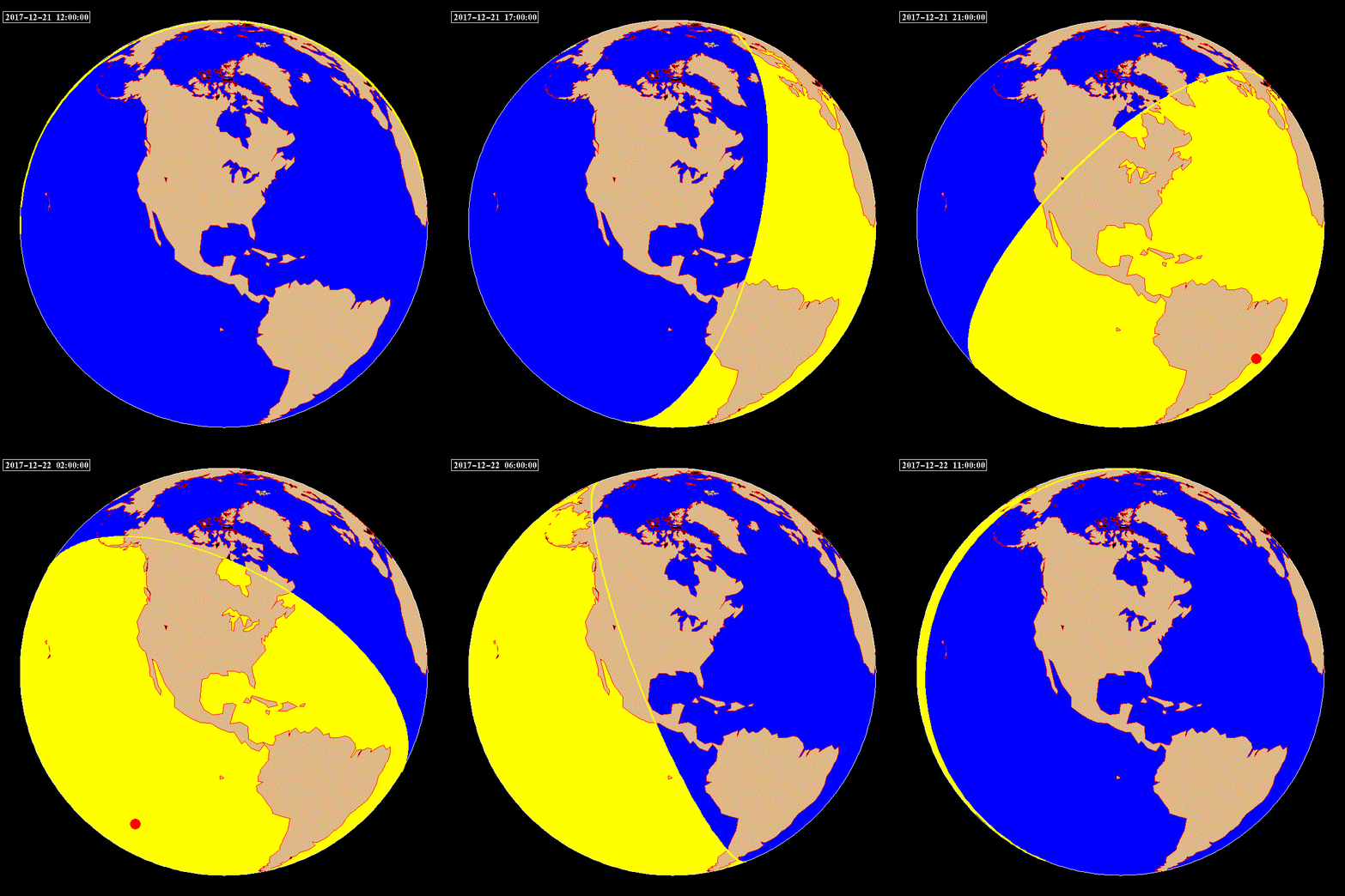
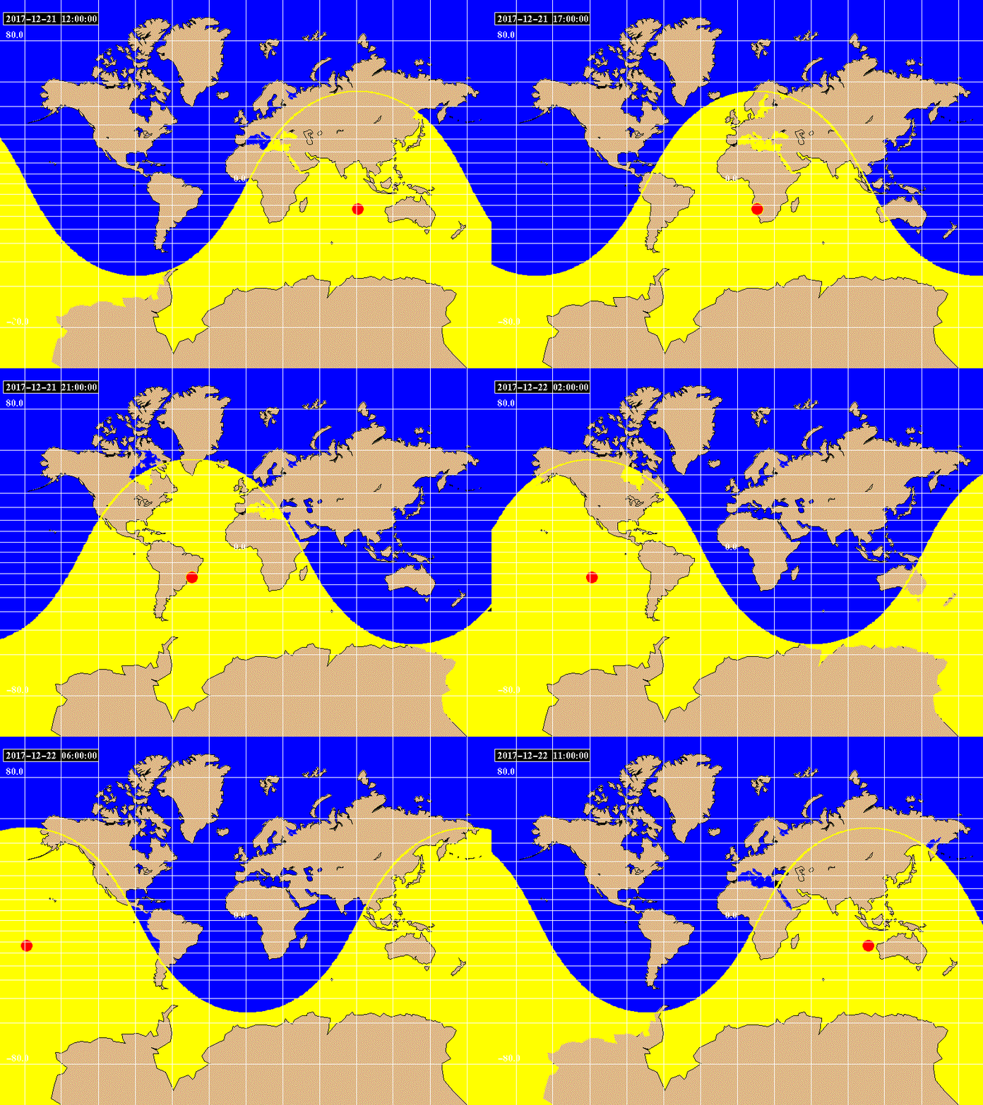
This is the Smoking Gun: In Winter, on the Flat Earth Map, the “Sun” would have to project light all over the earth, including all of Antarctica, while at the same time not shining a spotlight on half of the Earth. The animation below shows the shape of the required solar “spotlight” in winter. No spotlight can make such a pattern. And so, the Flat Earth is FALSE.
Web Article: On the Flat Earth, The Sun Never Sets!
by Dave Thomas
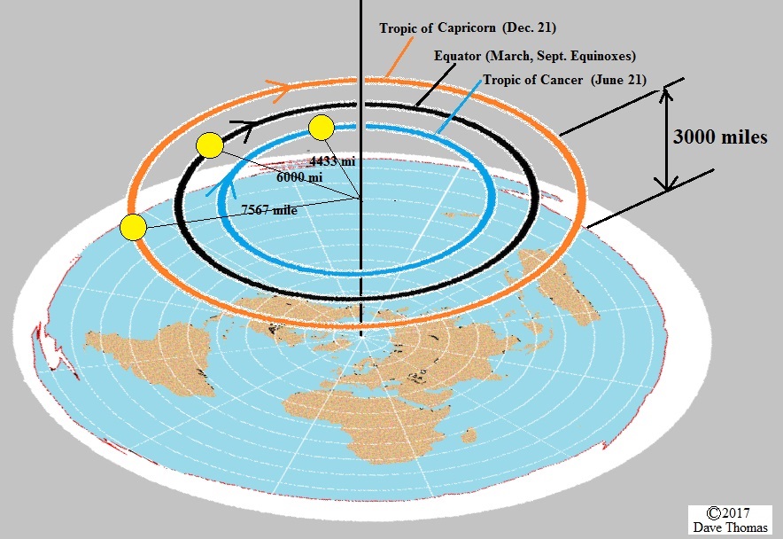
On this page, the paths of the sun in the Flat Earth model shown below are compared to the actual (a.k.a. “Round Earth/Globe Model/Heliocentric/Mainstream Science”) solar paths. I am assuming that the Sun floats 3,000 miles above the “flat” earth, and makes a circular orbit each day. (If this is not the best Flat Earth model, PLEASE send me a citation for a better one!) On June 21st, the radius of that orbit is some 4433 miles, putting the sun directly over the Tropic of Cancer. On December 21st, the radius of the sun’s orbit is some 7567 miles, putting the sun directly over the Tropic of Capricorn. On the Equinoxes (March 21 and Sept 21), the sun is directly above the Equator (with a radius of 6,000 miles). The Sun completes the circle once every day, going farther in December than in March or September, and going the shortest distance per day in June.
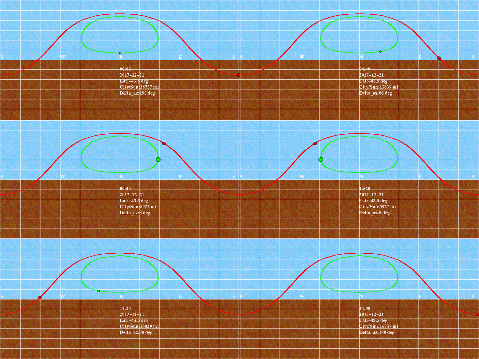
The image below shows the paths of real and FE suns in New Zealand on December 21st. This animation shows how the real sun (red) rises in the southeast, and sets in the southwest, all while the Flat Earth sun (green) stays entirely to the north, and never sets at all! (In fact, the lowest the Flat Earth Sun gets is 10 degrees above the horizon. That’s about the same as the width of your fist, held out at arms length!) To disprove the Flat Earth model, someone in New Zealand could simply observe the sun shortly before sunset on the evening of December 21st. If it appears in the SOUTHWEST, as the globe model demands, then the Earth is Round. (In the Flat Earth model, the sun would “set” in the NORTHWEST!)
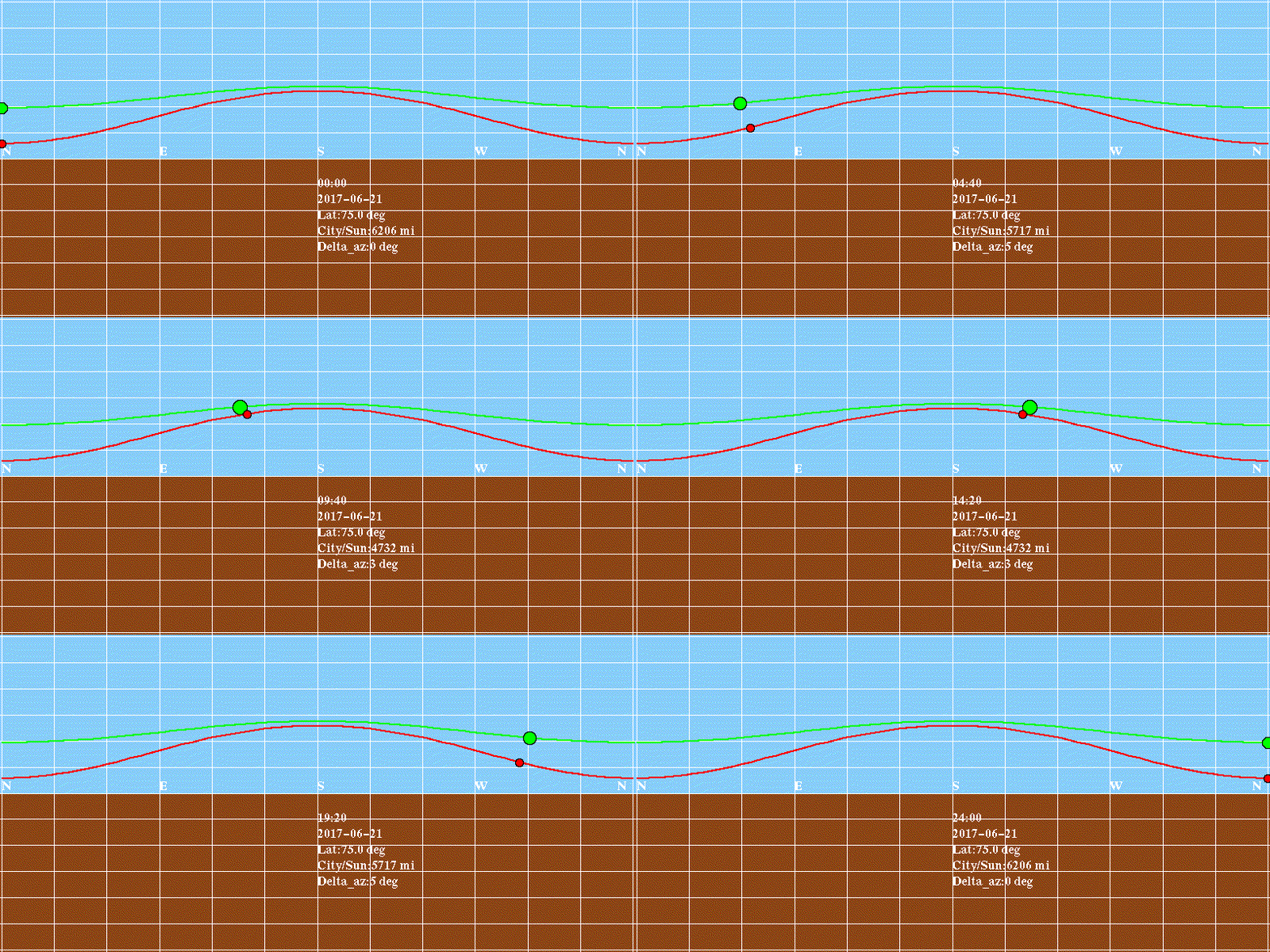
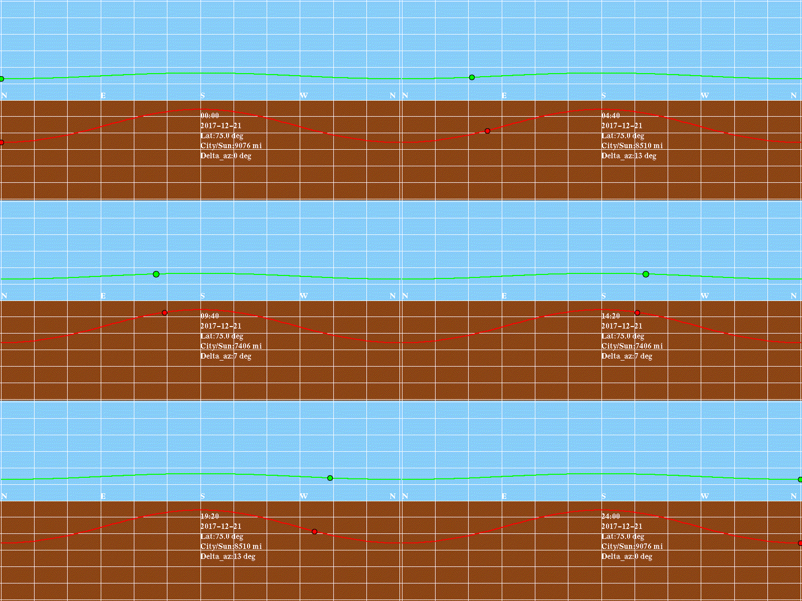
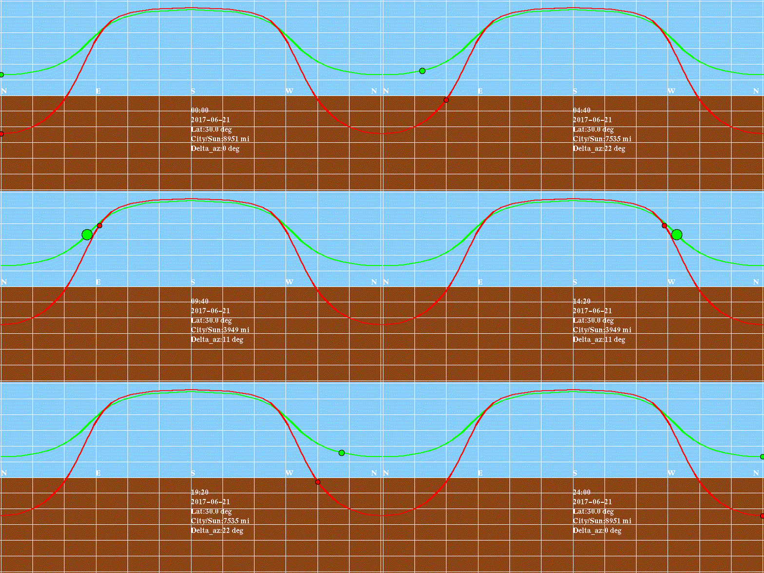
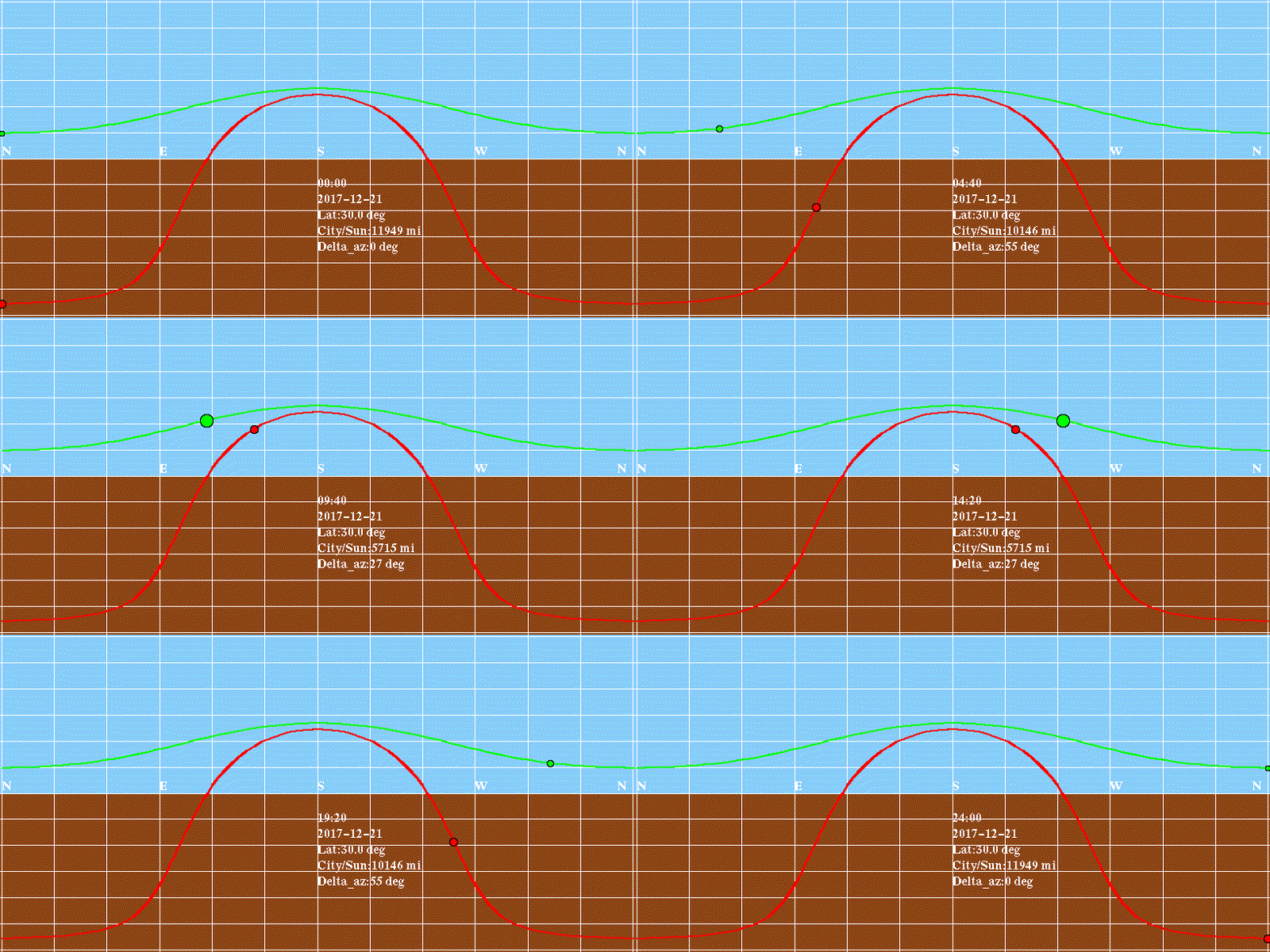
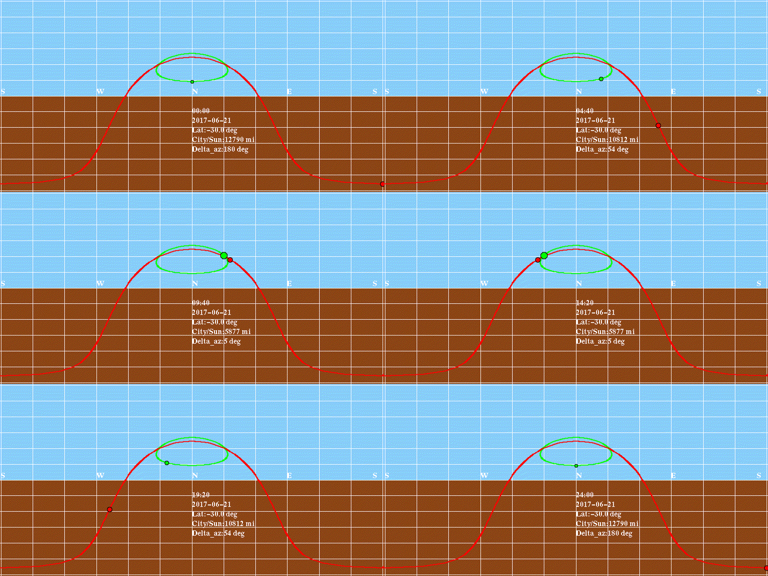
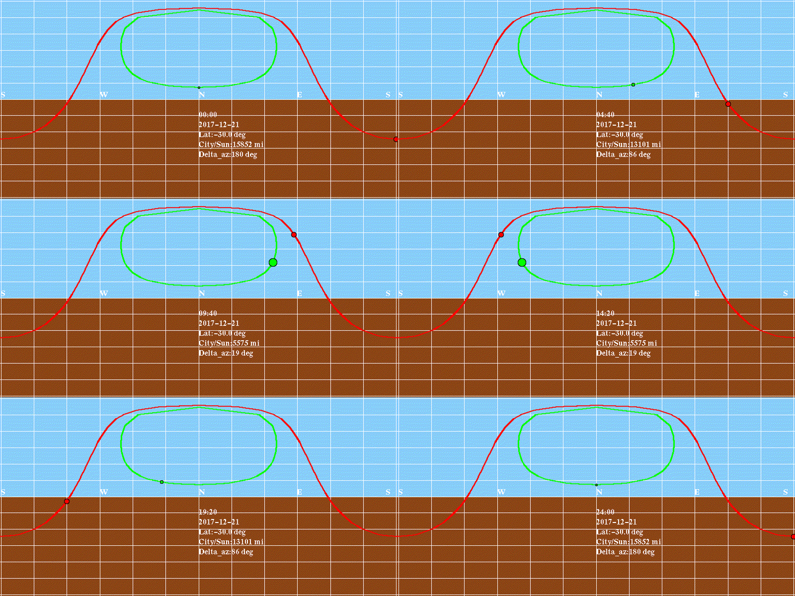
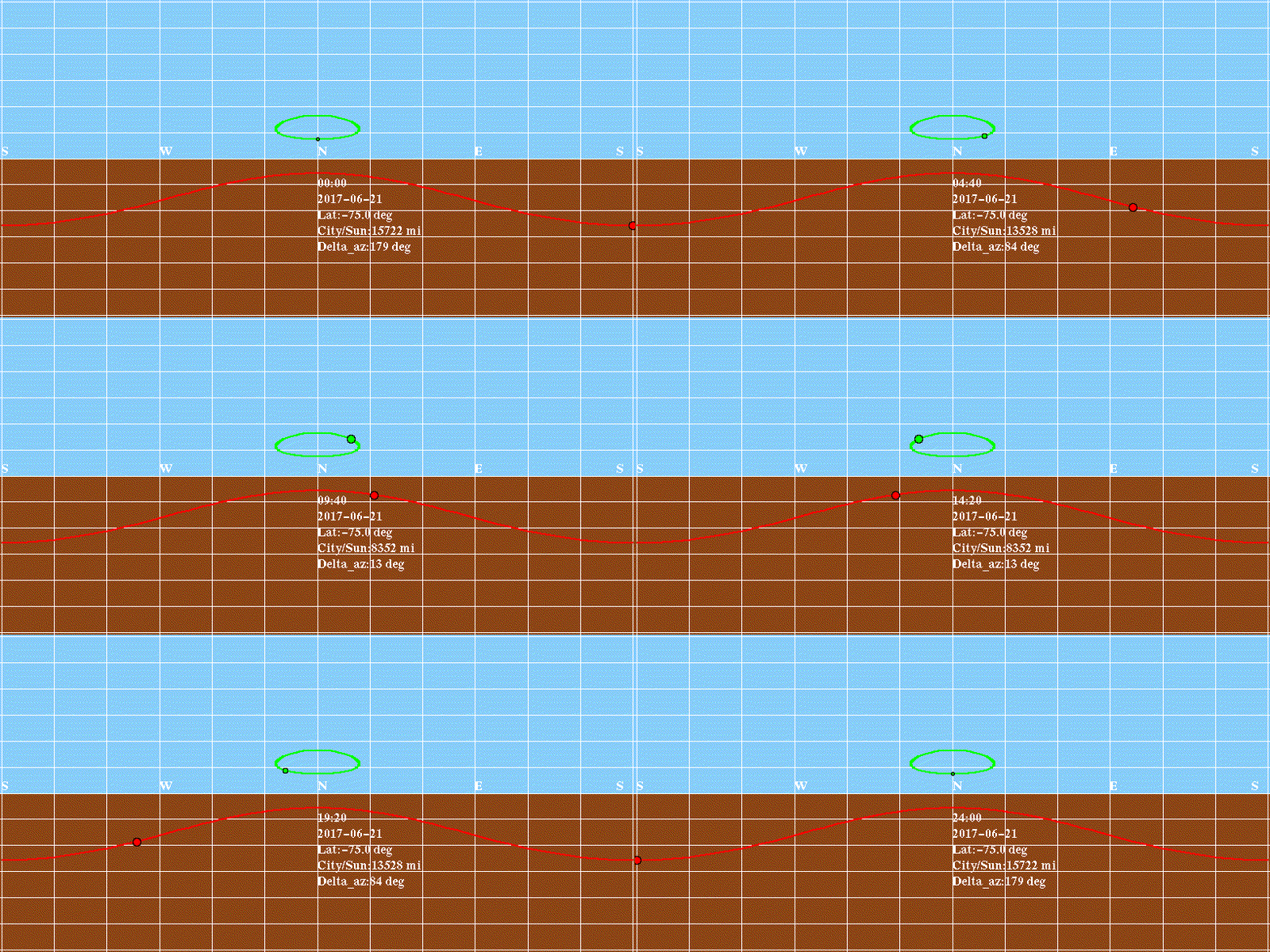
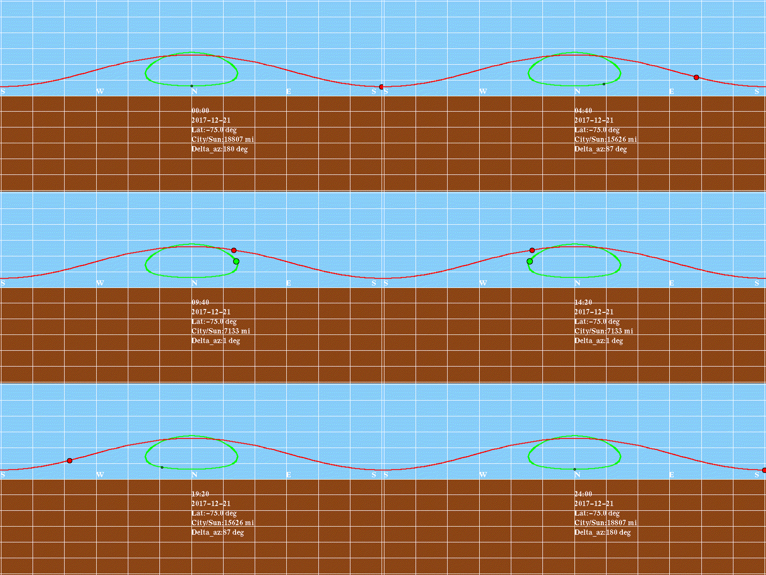
The sizes of both globe and flat-earth solar disks are exaggerated 10x for visibility; note that the Flat Earth sun changes size dramatically. Distances from the city that is the viewpoint (e.g. Christchurch) are indicated in miles, including the distance of the Flat Earth sun above the plane of the Earth (here, the flat earth sun is considered to be floating 3000 above the tropic of Capricorn). For this simulation, both real and FE suns are due north at noon. The grid is an Equirectangular Projection – it is simply straight elevation (15 deg. per grid box) and azimuth (30 deg. per box). Below the horizon is brown, and above it, blue. The central part of the projection is close to what you would see looking North or South; however, the grid encompasses the entire sphere, with azimuths from South to North to South again, and elevations from the Zenith to the Horizon to the Nadir. These animations were made with my own Python app, using the Python Imaging Library (PIL).
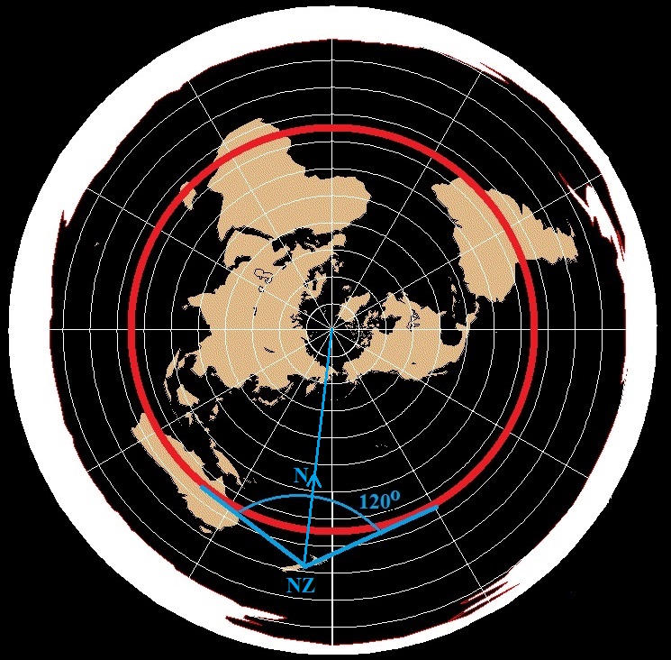
Here is the plan view of the Flat Earth on December 21st. The Sun is above the Tropic of Capricorn. Note that, as seen from New Zealand, the Sun will always be within 60 degrees of North, for a 120-degree span, just as is seen in the animation above.
The following animations show the comparison of globe and flat-earth models for both June 21 (Summer in North, Winter in South) and December 21 (Winter in North, Summer in South), for latitudes 75 North. 30 North, 30 South, and 75 South.
Note how the chart below, 75oN, June 21, Northern Summer, shows “Land of the Midnight Sun,” where both the globe and the flat earth sun never set. Both Flat Earth and Globe suns track left-to-right, above the horizon the whole time. Note how the flat-earth sun (green) changes size more dramatically.
On the next chart, for 75oN, December 21, Northern Winter, it shows no daylight at all (“Darkness at Noon”), whereas the Flat Earth sun never sets.
For 30oN, June 21, Northern Summer, days are longer than nights, but the sun rises and sets. Again, the Flat Earth sun never sets.
For 30oN, December 21, Northern Winter, days are shorter than nights, as the sun rises and sets over a shorter interval. Again, the Flat Earth sun never sets.
For locations in the southern hemisphere, things start to change dramatically. For 30oS, June 21, Southern Winter, the globe day is shorter than globe night. However, while the Flat Earth sun still doesn’t set, now it runs right-left-right-left to form a closed loop, rather than cruising from left to right.
For 30oS, December 21, Southern Summer, the globe day is longer than globe night. The Flat Earth sun now forms a larger closed loop, while never setting.
For 75oS, June 21, Southern Winter, there is no globe day, rather, 24 hours of night. The Flat Earth sun now forms a smaller closed loop, while still never setting.
The last chart, for 75oS, December 21, Southern Summer, shows southern-hemisphere “Land of the Midnight Sun,” where both the globe and the flat earth sun never set. While the Globe sun tracks right-to-left (looking north), the Flat Earth sun (green) cycles back-and forth over an angle a little larger than 60 degrees. This binary difference in Globe versus Flat Earth models was the basic for The Final Experiment, carried out in December 2024.
Conclusion: The Flat Earth model does not match reality, and is therefore falsified.